CHRISTOPHER EHLERS

Parametric design, Berlin

Scientific work, wintersemester 19/20

A utopia as an answer to the challenges of today's urban planning.

The task of our time is to develop new, sustainable and above all space-saving solutions for the coexistence of man with his environment in the city.

Urban spaces have always been a driver of interests, exchanges, innovations, hopes and conflicts. The increasing urbanization of the world offers humanity a multitude of opportunities, but also poses challenges.

Where do we go from here? Are there any new big ideas? One that can replace the ideal of the "car-friendly city" and promote a dense city?

In an academic paper, I looked at data-based parametric urban planning and how the city might be treated in the future. In doing so, I considered the challenges of today's urban planning and analyzed various urban utopias of the past decades with regard to their topicality.

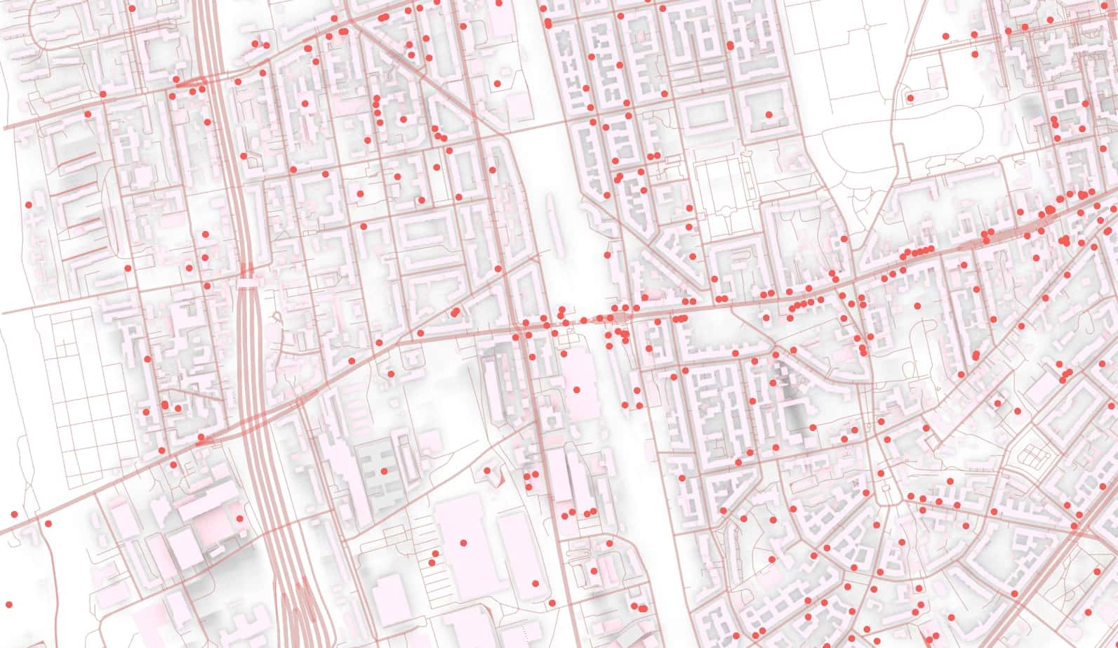
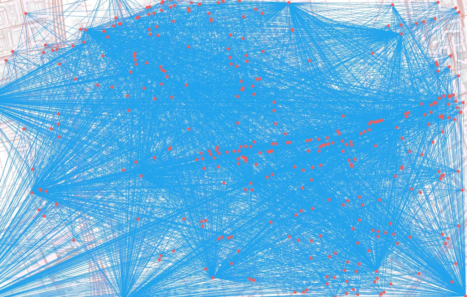
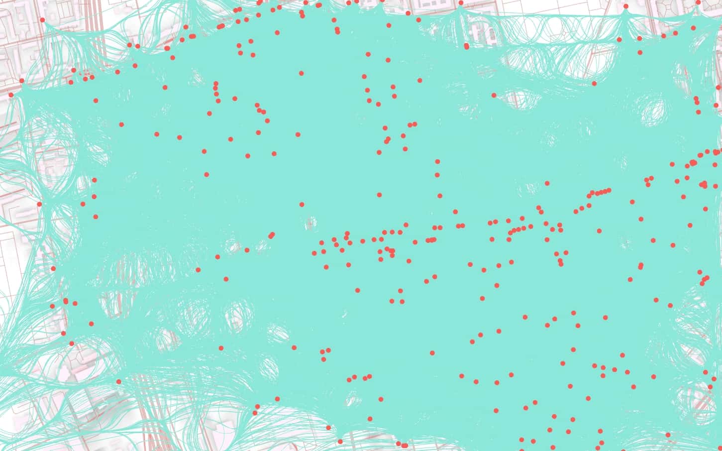
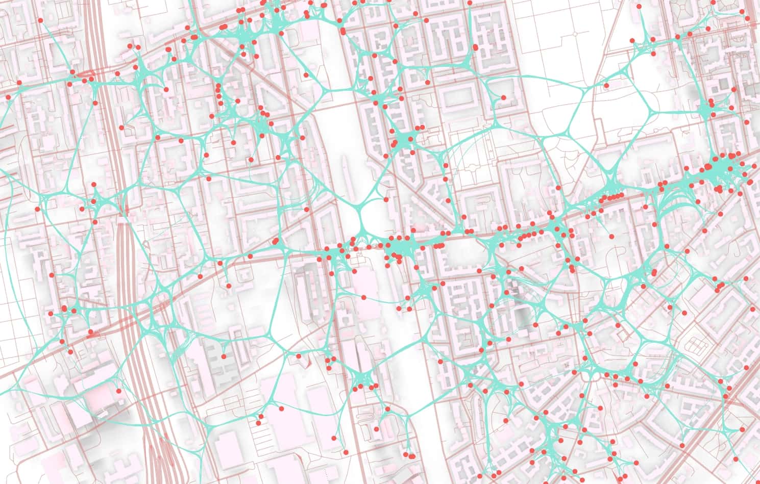
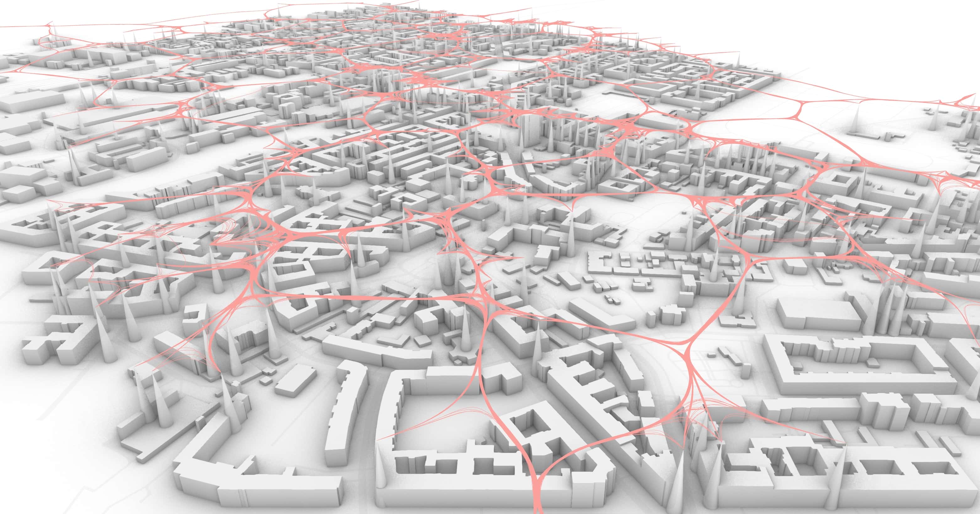
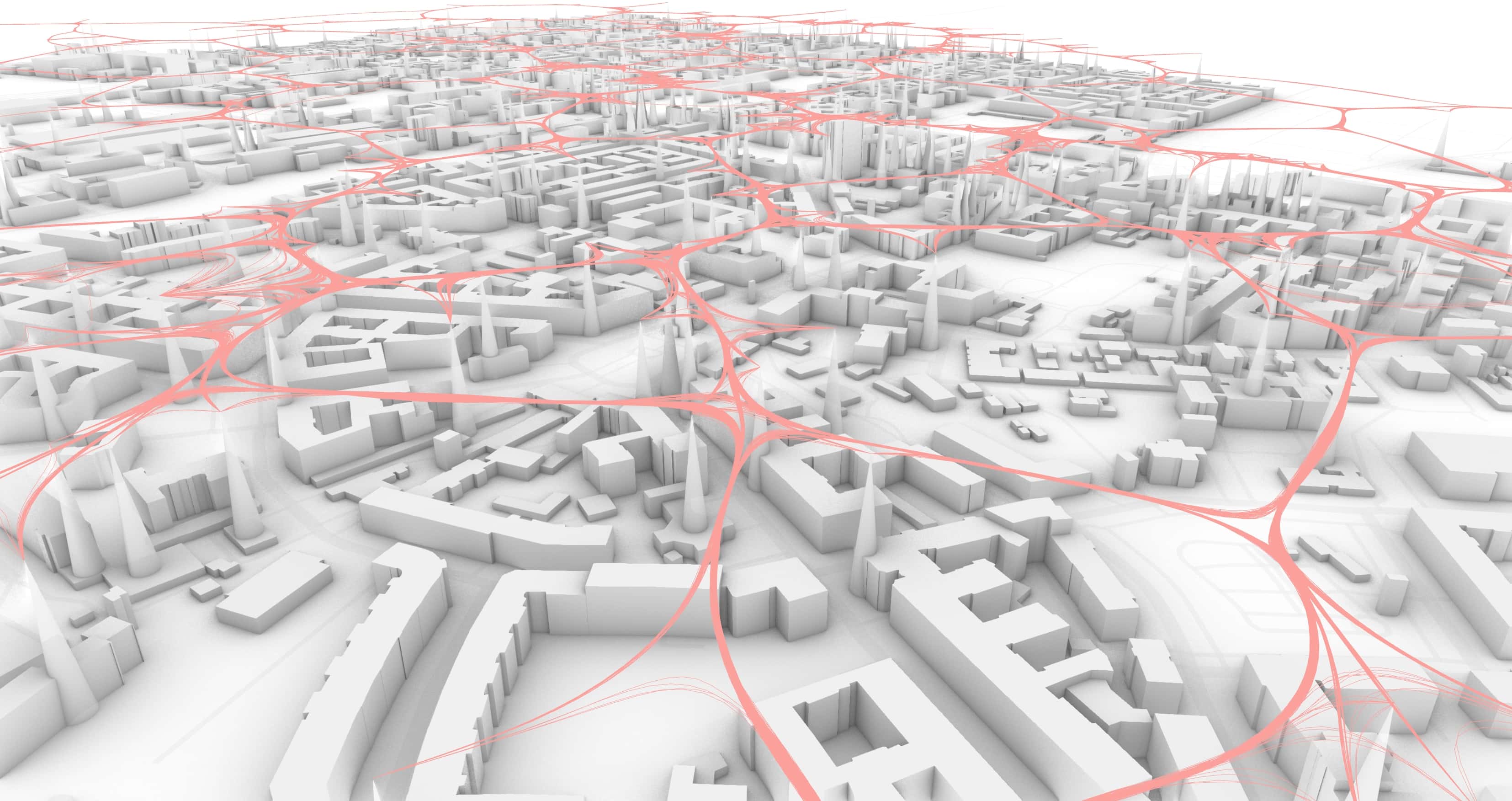
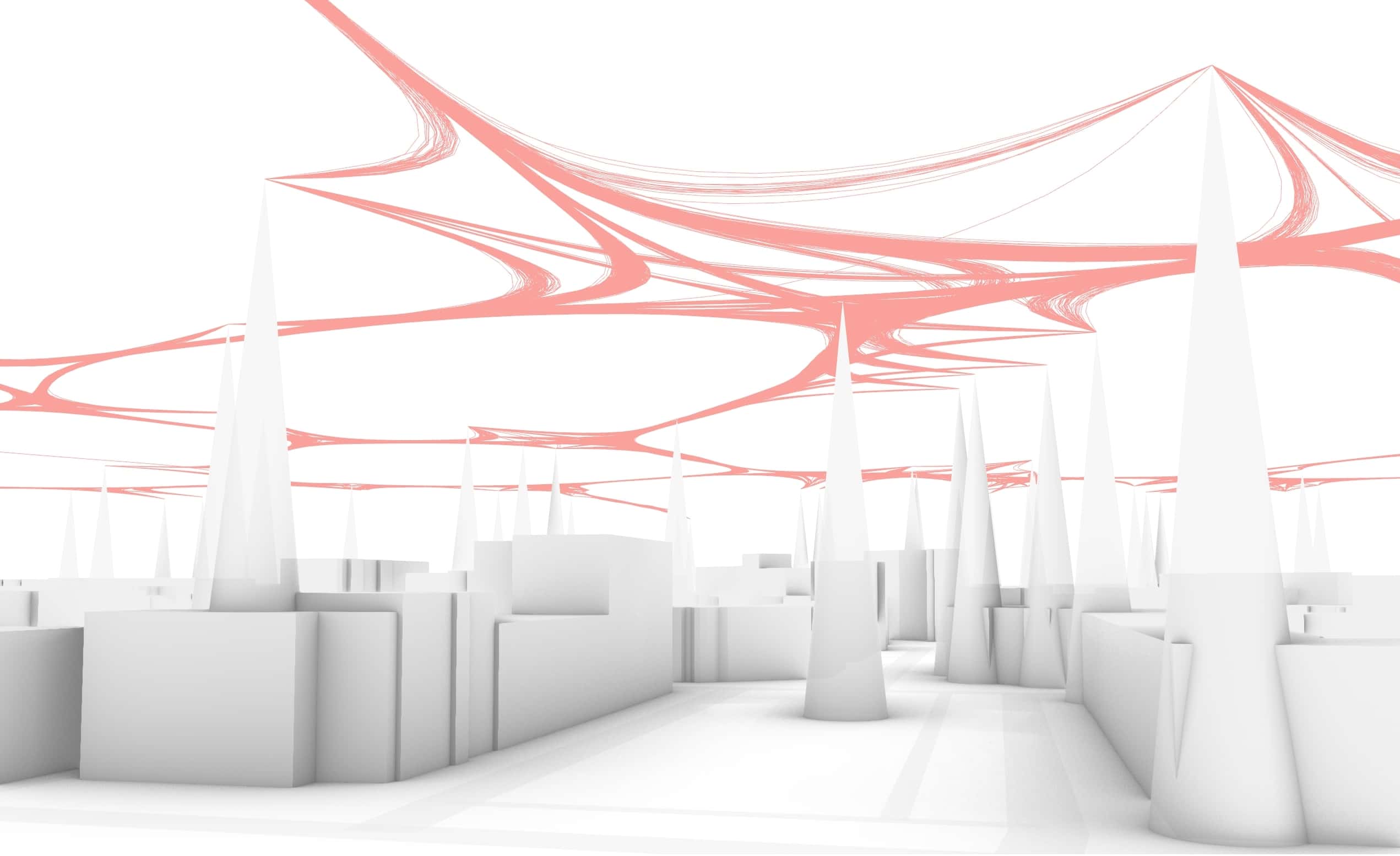
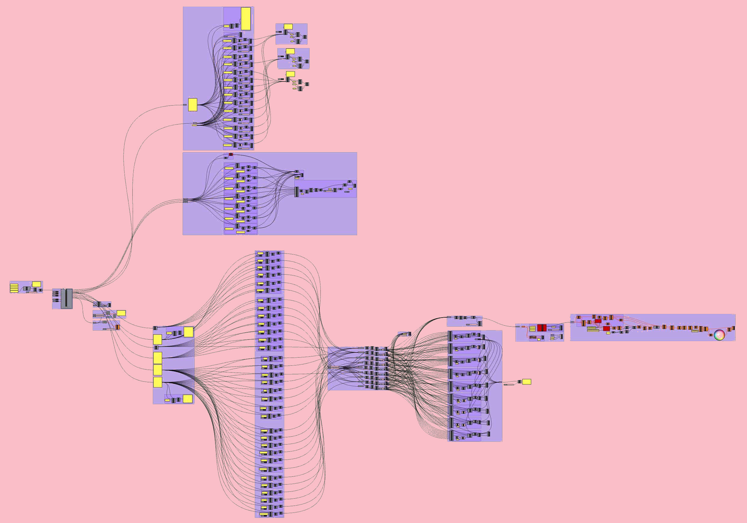
In a separate application example, the possibilities of parametric urban planning with the help of Open Street Map data are discussed, partly experimentally.

Project 4 - WissA/WissA-Karte1.jpg
Step 1 - Using Open Street Map (OSM) data, a map is created with buildings, streets and amenities. The red dots represent the amenities.
Project 4 - WissA/WissA-Karte2.jpg
Step 2 - All motion streams are superimposed, i.e. all points are connected with lines, creating a dense network of 135,000 lines. Due to the high density, individual connections cannot be recognized. A reduction of the lines, by hiding similar lines, makes places with a high amenity density visible.
Project 4 - WissA/WissA-Karte3.jpg
Step 3 - In the second step, the amenities were manually analyzed and categorized. Less important items such as mailboxes were removed. A total of approximately 350 amenities were then used for the work. The connecting lines were then bundled using the edge bundling method.
Project 4 - WissA/WissA-Karte4.jpg
Step 4 - The resulting network cannot yet be described as a path network; the many individual connections already indicate points of higher connection density, but a clear statement cannot be made. In order to bundle the individual strands more strongly, the edge bundling method is used. A new network of paths becomes visible, which is laid out over the city. Stronger strands, i.e. wider paths, are recognizable in places with more amenities. The new path network represents the optimum of detour and the shortest path network, whereby urban amenities are well connected.
Project 4 - WissA/WissA-Perspektive-1.jpg
Step 5 - To hierarchize individual amenities, the results of the survey on residential subtitle preferences by Hermann Köhler, from the Chair of Computer Science in Architectural and Social Science Urban Research at the Bauhaus University Weimar, are used. By hierarchizing the amenities, a path network can be produced that takes into account the different qualitative meanings of the urban amenities. With the help of edge bundling, the path network of 44,000 lines is optimized.
Project 4 - WissA/WissA-Perspektive-2.jpg
Perspective of the urban superstructure
Project 4 - WissA/WissA-Perspektive-3.jpg
Pedestrian perspective of the urban superstructure, the cones represent the amenities
Project 4 - WissA/WissA-Felder.jpg
Fields in the space between create a new natural block structurer
Project 4 - WissA/WissA-Rhino.jpg
Screenshot of the Grasshopper script
Fazit
The consideration of urban planning challenges have shown that there are numerous opportunities to mitigate the climate crisis and improve urban social structures. Not only are cities getting bigger, but they are also having an ever-increasing impact on our quality of life. A lot has happened in urban development since the 1960s, and now the Athens Charter is considered outdated and the pursuit of a car-friendly city is changing to a desire for a dense city with a high quality of life and answers to climate problems.

In my utopia "Raumstadt 2.0" I have taken up various utopias of the 60s and 70s and combined them with the concept of the dense city.

The proposal of a three-dimensional spatial superstructure allows the accommodation of a lot of living, living and working space while requiring very little land. As a response to the return to a pedestrian-friendly and green city, the design reinvents the city's public space. Some of the currently sealed areas, such as streets, can be transformed into new green spaces. Moving together in the city creates more living space and avoids redlining. Sensibly laid and efficient traffic routes and new social spaces promote interaction and togetherness among the population. The spatial network acts as a catalyst on the social urban space, existing urban attractors are strengthened. The short path relationships and dense linkages of amenities help build an urban structure based on the city of short distances. By growing upwards, valuable green space can be preserved and further expansion of the city into the surrounding countryside is avoided.

The model of a new and qualitative network of paths above the existing urban structure is intended to provide inspiration for the expansion and reconstruction or further development of our current cities.

The complete scientific work can be found here (in German).

See more projects or back to home.